Shire of Bridgetown-Greenbushes Advocating for Safer Speeds
The Shire of Bridgetown-Greenbushes has successfully implemented an area wide 40km/h speed limit across the Greenbushes town site. A proactive move to improve safety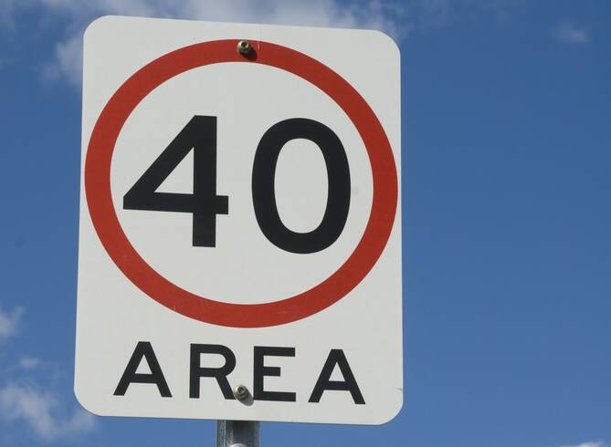 for pedestrians and enhance liveability by creating slower, safer streets, especially with the increased presence of heavy vehicles.
This achievement demonstrates how Local Government leadership and advocacy, backed by data, community support and localised knowledge can drive meaningful change. By applying proven road safety strategies, the Shire established safer, more liveable streets for everyone.
The process began in April 2022 with a request to Main Roads WA (MRWA) to lower the speed limit on Stanifer Street, the town’s main road. This route sees frequent heavy haulage traffic accessing the Talison Lithium mine, has predominantly residential access and is a key crossing point for school children and residents, with Greenbushes Primary School located nearby.
As part of the Shire’s process to review and apply for speed limit changes, relevant data was collected, and a road environment review was conducted to support the application. The request was formally submitted to MRWA in July 2022. Despite evidence that other towns have received reduced speed limits on highways and main streets through town sites, the response received in September 2023 indicated the application was unlikely to be supported.
Following this, the Shire continued to advocate for a lower speed limit, concerned that the default of 50km/h was not appropriate given the mix of heavy vehicles, vulnerable road users and the surrounding land use. The Shire reached out to the Minister for Transport and the Minister for Road Safety to initiate further discussions.
In early 2024, MRWA advised that precinct wide 40km/h zones could be considered to support pedestrian safety and create safer environments across a wider area. In April, the speed limit reduction on Stanifer Street was approved and MRWA recommended extending the limit across the entire town site. Due to this being different to the original request, the Shire consulted the community via a mail-out, which saw support for the proposed area wide reduction. In May 2024, the speed limit across the town site of Greenbushes was reduced to 40km/h.
This success is an example of what can be achieved when strong advocacy, evidence and community engagement come together. Creating safer more liveable towns which prioritise people.
City of Bunbury Improves Safety at Wisbey / Ecclestone Street Roundabout
The City of Bunbury has improved safety at an existing roundabout by installing speed platforms to reduce approach speeds and create safer crossing points for vulnerable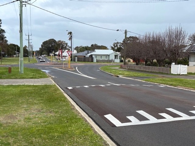 road users.
Although the Wisbey Street / Ecclestone Street roundabout is an existing roundabout, it has been identified as having some safety concerns. While the overall number of crashes at this location was relatively low, the severity of incidents highlighted the need for improvements. To address these risks, the City successfully secured Black Spot funding to improve safety and ensure the roundabout functions as intended.
Roundabouts are a proven safe system solution for intersections. Well-designed roundabouts, slow vehicles, create safer intersection speeds, reduce complexity and change the angles of impact if crashes occur, which results in more survivable outcomes.
With the funding, raised plateaus were installed on all four approaches to the roundabout. These traffic calming devices are designed to reduce vehicle speeds on approach, enhancing both the safety and functionality of the intersection. Importantly, the placement of the raised plateaus was carefully coordinated with existing pedestrian facilities. Where necessary, the plateaus were positioned before footpath crossing points, further improving safety for people walking and cycling by ensuring vehicles slow down before reaching pedestrian areas.
The improvements to the Wisbey / Ecclestone Street roundabout have resulted in a safer intersection for all users. Through a combination of ongoing monitoring, data gathering and analysis, the City of Bunbury has successfully applied effective road safety treatments to reduce vehicle speeds and enhance pedestrian safety. By applying safe system principles, the City is creating safer and more protective intersections.
Shire of Dardanup Intersection Upgrades to Improve Safety and Traffic Flow
The Shire of Dardanup has recently completed a series of intersection upgrades along Eaton Drive to address long-standing road safety concerns, improving traffic flow and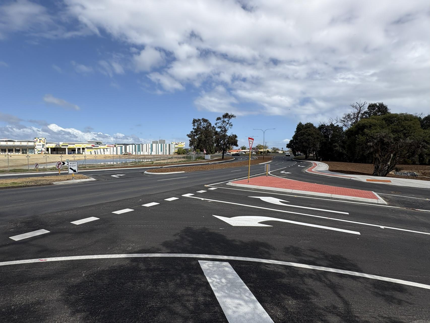 reduce complexity along this busy corridor.
This project reflects the Shire’s commitment to safer, more efficient road infrastructure through strategic planning and investment. Rather than treating intersections individually, a corridor-wide approach was adopted to deliver coordinated improvements across multiple sites, reducing conflict points and enhancing safety for all road users.
Why the Upgrades Were Needed
Since 2020, the Shire has been investigating safety and operational issues along Eaton Drive, particularly around the Hamilton Road / Eaton Drive / Council Drive roundabout. The close proximity of the Hands Avenue intersection to this roundabout was identified as a major contributor to traffic complexity and vehicle conflict. Following detailed studies, design development and community consultation, a plan was endorsed to implement targeted treatments aimed at reducing risk and improving overall network performance.
What has Been Done
- Signalisation of Glenhoun Boulevard
The intersection was upgraded with traffic signals to improve control and reduce crash risks. Pedestrian crossings were also added to prioritise safety for vulnerable road users.
- New Cudliss Street intersection
A new intersection was constructed further from the roundabout to reduce conflict and provide clearer, safer vehicle movements. Key features include:
-
- A right-hand turn lane with median upgrades allowing single turning movements only across traffic.
- A dedicated turning pocket on Eaton Drive so vehicles can slow down safely without disrupting through traffic.
- Closure of Hands Avenue access to Eaton Drive to reduce conflict near the roundabout.
- Watson Street cul-de-sac and pedestrian crossings
Watson Street was closed at Cudliss Street to support the new intersection. Works also included a re-aligned footpath, new pram ramps and upgraded median break to enhance pedestrian safety.
- Pre-deflection of Eaton Dr on the approach to the Hamilton Rd roundabout
This was included in the scope of works to both slow traffic speed on the approach to the roundabout and provide a wider pedestrian refuge in the Eaton Drive median.
- Left-out only treatment at Hamilton Road and Anne Street
Restrictions on turning movements will simplify traffic flow and reduce potential conflict points. These works will be commenced at later date.
The Benefits
By taking a corridor-wide approach, the project is expected to:
- Reduce traffic complexity and conflict near the roundabout.
- Improve safety for all road users.
- Enhance traffic flow and operational efficiency along Eaton Drive.
- Minimise high-risk turning movements through targeted design treatments.
The Shire of Dardanup remains committed to evidence-based planning and coordinated design to deliver safer, more integrated mobility for the community.
Shire of Harvey: Promoting Effective Action Towards Better Practice Road Safety
In a recent community-facing update, the Shire of Harvey reaffirmed its commitment to road safety. By showcasing road safety as a core part of its work, the Shire highlighted the actions that are supporting its progression towards the delivery of better practice road safety.
In addition to celebrating its 5 Ribbon status under the 2025 RoadWise Recognised initiative, an accomplishment which reflects a holistic approach to road safety with action delivered across the organisation, the promotional update outlined:
What has been delivered: a range of actions implemented across the organisation, demonstrating a coordinated and holistic approach to road safety.
What is being progressed: priority initiatives aimed at embedding road safety and best practice into governance, planning and operational decision making, while also establishing a way to monitor results.
What is working: evidence-based actions that are contributing to reductions in serious injuries and fatalities across the local network and building understanding of effective road safety initiatives.
Effective road safety promotion involves the ongoing and deliberate communication of road safety as a strategic priority, embedded in governance, policy and operational practice. By leveraging its communication channels, the Shire is creating opportunities to generate broader road safety awareness and deliver greater benefits for its community.
Publicly showcasing actions that are proven to work and establishing transparent ways to monitor road safety progress, supports both internal decision-making and community expectations – ultimately driving systemic change and contributing to reduced road trauma.
To see how the Shire promoted its effective action visit the Shire of Harvey’s RoadWise Update.
Shire of Manjimup’s Innovative Road Hierarchy Policy: A Commitment to Best Practice
The Shire of Manjimup is transforming how it manages, builds and maintains its road network, proactively moving towards safer roads for their community.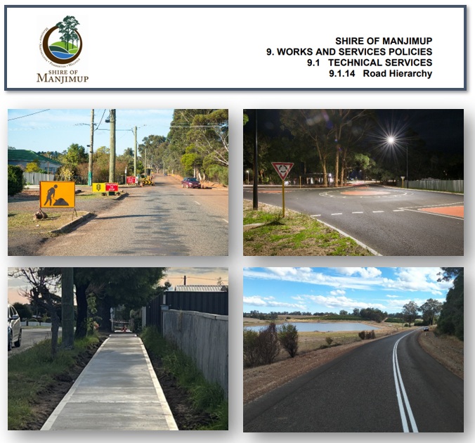
Recently, the Shire undertook a comprehensive review of its Road Hierarchy Policy to align it with the Shire’s overarching Road Traffic Safety Policy. This review was not just about policy alignment but also about embedding best practices and the safe system approach into every aspect of road construction and maintenance.
Continuing their commitment to road safety, the Shire has been progressing through the adoption of international standard ISO 39001 Road Traffic Safety Management Systems. This work has established the Shire’s leadership in road safety through the development of an overarching Road Traffic Safety Policy. This policy ensures a robust approach to road traffic safety by embedding safe system methodology across organisational activities. It applies to all Shire managed roads, roadsides, footpaths and cycle paths, directly informing and influencing the systematic review process of policies to ensure alignment with this overarching policy.
Their Road Hierarchy Policy is a key document which identifies minimum standards for road construction and maintenance to Council, the Shire and the community. Review of the policy was highlighted as a priority for update to align with their Road Traffic Safety Policy and for embedding best practices and safe system. Endorsed by Council in April 2025, the updated Road Hierarchy Policy redefines road hierarchy levels to incorporate movement and place principles, setting clear design principles for construction and maintenance and incorporating safety interventions. It also outlines effective road safety treatments and establishes minimum safety standards for high-order roads.
The innovative policy demonstrates the Shire’s dedication to road safety, setting a new benchmark for practical application of best practice road safety in road management. It ensures that the Shire is implementing evidence-based interventions within its role of building, managing and maintaining a safer road network for its community.
The updated policy is available on the Shire of Manjimup’s website by following this link 9.1.14 Road Hierarchy.
Shire of Augusta Margaret River Speed Limit Reduction
In April 2023, a reduced speed limit of 70km/h was applied to rural residential roads which were not previously speed zoned and therefore were the default speed limit of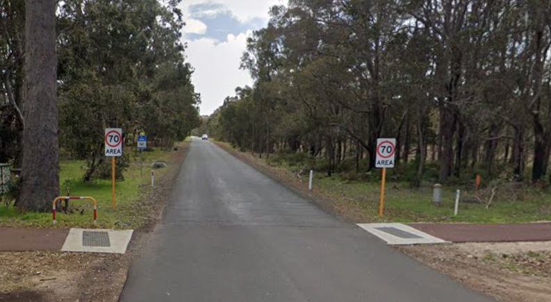 110km/h.
Following a fatal car crash on Kevill Road in 2019, the Shire of Augusta Margaret River applied to Main Roads WA to review and apply a posted speed limit to improve safety along the stretch of road.
The default speed limit of 110km/h is not considered a safe speed for Kevill Road due to it being a narrow seal, tree lined with short clear zones, a windy road with no line markings and having a number of intersections and rural property entries. Through consultation with Main Roads WA the Shire applied for an area-wide speed limit reduction on Kevill Road and all the adjoining rural residential roads, as the Main Roads WA policy would not allow a single speed limit to be imposed on an individual road within a network of similar roads.
After assessment, a speed limit of 70km/h was deemed appropriate through Main Roads WA’s speed zoning policy and guidelines, and the speed limit was lowered in April 2023.
Subsequently, under the Safer Speeds Trial, a further reduction to 60km/h was implemented in August 2025. This adjustment was based on a harm minimisation approach, taking into account the physical characteristics of the road environment, human tolerance of crash forces, the presence (or absence) of protective infrastructure and the community demand and road usage. The revised speed limit is aligned with contemporary road safety principles and evidence-based practice to reduce road trauma.
To inform the community, celebrate the success and support the road safety outcome, the Shire promoted the change through media communications. The communications celebrate the successful advocacy and result of the safer speed limit to improve safety on these roads; they also remind drivers to drive to conditions and that a speed limit is the safest speed to travel in ideal conditions.
Informing the community builds support and raises awareness of changes and new interventions also an opportunity to promote best practice road safety and share the effective road safety interventions the Shire is delivering.
Shire of Bridgetown-Greenbushes Local Roads Speed Monitoring Program
The Shire of Bridgetown-Greenbushes conducts a traffic counter and speed monitoring program which applies the traffic tubes to local roads based on an annual program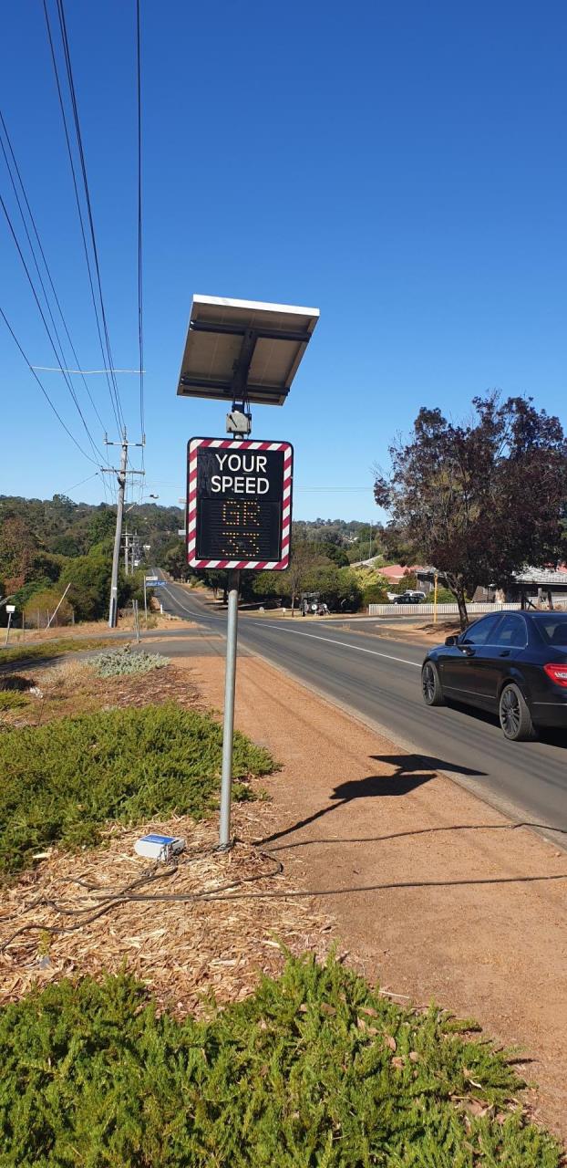 working to assess all local roads.
The program ensures that all roads are assessed and monitored with the data being applied to asset management, planning and development, identifying road upgrade requirements and funding applications.
Through the program, the Shire captures data including vehicle speed, traffic volumes and types of vehicles using the road, aiming to monitor road capacity, speed and gain accurate and reliable data.
This data is used to monitor the local network and identify streets which have a speeding issue as these can be forwarded onto local police. The data is also used to determine if infrastructure interventions are required, identify roads where traffic volumes are exceeding limits and upgrades may be required or to assist in forward planning and budget allocation.
Reliable and accurate road safety data is essential in planning effective safety policy and treatments and monitoring performance. Collecting vehicle speed and volume data assists the Shire to correctly identify problem areas, risk factors and priority areas, formulate strategic plans, appropriate actions and monitor performance over time.[1]
Through the application of this program the Shire captures vehicle travel speed data which is all sent to the local police who can use this to plan their enforcement program on streets identified with speeding issues. The Shire has built a strong partnership with the local station and the provision of this information can prompt quick and effective targeted speed enforcement.
Enforcement is a key element for reducing fatal and serious injuries. When implemented well, enforcement and the threat of fines and potential loss of licence act to deter road users from participating in risky behaviour.
[1] Road Safety Toolkit, Road Safety Data. https://toolkit.irap.org/management/road-safety-data/, December 2024.
Shire of Augusta Margaret River Working to Connect Missing Pathway Links
The Shire of Augusta Margaret River has been working to improve safety for people walking and wheeling and to encourage more active forms of travel. With missing links of the path network being completed to ensure a continuous and safe route for pedestrians and cyclists, separated from vehicles.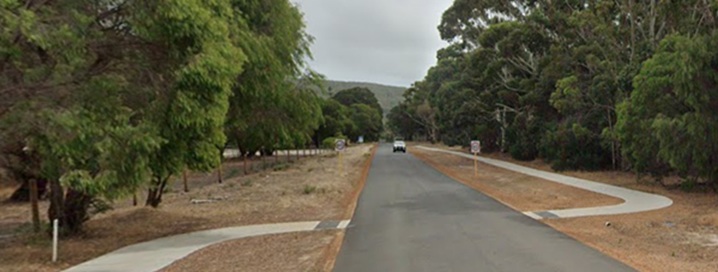
The Shire has recently completed a missing link of path network in Augusta, with a new 168m path being constructed along Hillview Road between Hart Road and Investigator Avenue. Previously the community would have either had to walk or cycle on the road or along the verge, where the speed limit is 60km/h and reduces to 50km/h as it heads east towards the Augusta townsite.
For vulnerable road users, when conflicts with vehicles occur, the speed the vehicle is travelling is important. Vulnerable road users have little to no protection and in the event of a crash the likelihood of survival greatly reduces when speeds increase above 30km/h.
The provision of a path network, separated from vehicles, provides pedestrians and cyclists with a facility which provides greater protection for them when using the network.
The project has been jointly funded by the Shire and the State Government, as part of the Western Australian Bicycle Network (WABN) Grants Program; a state funded initiative providing funding for planning, designing and constructing of active transport infrastructure.
Through the WABN Grants Program, the State Government is committed to investing in safe, attractive and connected infrastructure that supports increased safety for people who walk, wheel or ride, improves access to strategic destinations, and increases cycle tourism opportunities.
The Shire also highlighted this project to the community through their communications and via their website.
Find out more here; Connecting Our Pathways | Shire of Augusta Margaret River (amrshire.wa.gov.au)